Tengrinews.kz - Researchers from The British Antarctic Survey (BAS) have published the most detailed map of Antarctica without ice cover, according to New atlas.
The study by British scientists was published in the journal Scientific Data. The map was compiled using data collected over sixty years of research using aircraft, satellites, ships and dog sleds, as well as changes in radar, sonar and gravity anomalies.
What is the difficulty of the study
Antarctica is considered the most difficult continent to map, since almost all the land and a significant part of the sea around the continent is covered in ice. Seventy percent of the world's fresh water is stored under the eternal ice cap. Given that the average ice thickness is 1.9 kilometers, very painstaking research would be required to compile such a map without computer models.
This is the third such map created by The British Antarctic Survey (BAS) and a team of international scientists since 2001. Its goal is to study the bedrock of Antarctica.
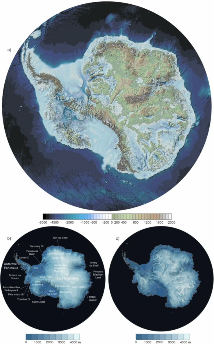
Computer model of Antarctica without ice. BAS
What scientists have found
The findings include Antarctica's highest mountains and deepest canyons, as well as points where ice extends to depths of up to 4757 meters. The study sheds light on the mechanics of glaciers moving across the continent's surface and how warm underground rivers affect the ice. Melting glaciers at the South Pole could have global consequences.
"This is the fundamental information that underpins the computer models we use to investigate how the ice will flow across the continent as temperatures rise. Imagine pouring syrup over a rock cake – all the lumps, all the bumps, will determine where the syrup goes and how fast. And so it is with Antarctica: some ridges will hold up the flowing ice; the hollows and smooth bits are where that ice could accelerate," said Dr. Hamish Pritchard, a glaciologist at BAS and lead author on the study.
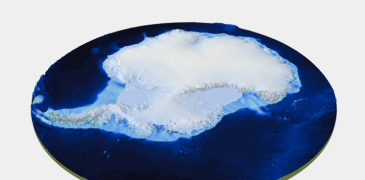
BAS image
The accuracy of the bedrock map depends on the presence of ice. If you take it away, everything changes. For one thing, the water in the ice would have to go somewhere, causing sea levels to rise by 58 metres. The total weight of the ice cap covering Antarctica is 24 759 quadrillion tonnes. If you remove that weight, the continent would effectively spring up out of the ocean. A similar process has already occurred in Europe, North America and Asia, which have been rising for 12 000 years, since the last ice age.
This is why terms like mean sea level aren't as simple as they first appear and tend to be really old oceanographers and geodesists.