Tengrinews.kz - An earthquake was recorded 234 kilometers southwest of Almaty, Kazakhstan’s seismologists reported.
The tremors were registered by the seismic monitoring network of the National Scientific Center for Seismological Observations and Research under the Ministry of Emergency Situations on May 12 at 06:33 a.m. Astana time.
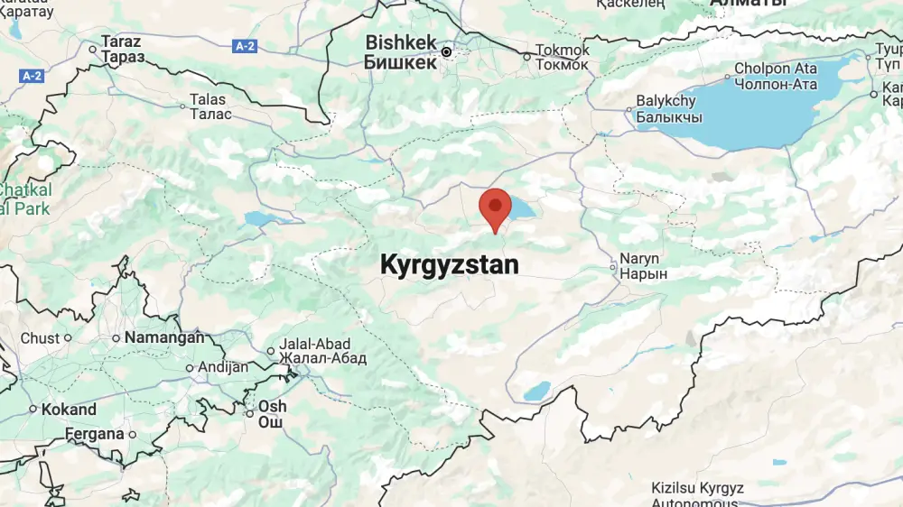
"The epicenter was located 234 kilometers southwest of Almaty, on the territory of Kyrgyzstan. The depth was 10 kilometers. The energy class of the earthquake was 10.4, with a magnitude of MPV 4.8," the report said.
Officials noted that the earthquake was not felt in Kazakhstan.
According to Kyrgyzstan’s Institute of Seismology of the National Academy of the Sciences, the epicenter of the 4.3-magnitude quake was located 9 kilometers northwest of the village of Jany-Talap.
The intensity of the earthquake in Kyrgyz villages was as follows:
- 3.5 points in Jany-Talap, Ak-Kyya, and Kok-Jar
- 3 points in Kydyraly, Sary-Iymek, and Baychenchek.
Earlier, on May 11, an earthquake occurred at the Tengiz oil field in western Kazakhstan.