16 April 2015 | 12:02

Flooding in Kazakhstan as seen from satellite

viewings icon comments icon

ПОДЕЛИТЬСЯ

whatsapp button telegram button facebook button
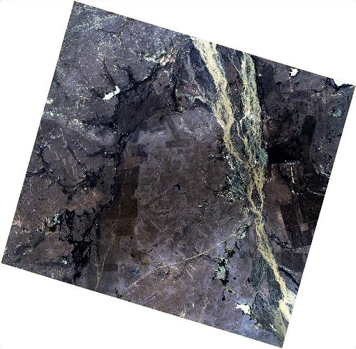
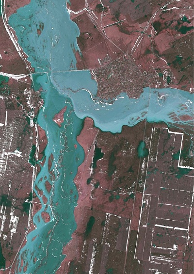
Koktas village on 13.04.15 as photographed from KazEOSat-1 Koktas village on 13.04.15 as photographed from KazEOSat-1

Kazakhstan Gharysh Sapary has published satellite photos of the flooding in Karaganda Oblast in central Kazakhstan made from Kazakh high resolution remote sensing satellite KazEOSat-1, Tengrinews reports.

The first wave of flooding in Karaganda Oblast happened between March 23 and 29. It affected four Districts in the Oblast.

The second wave started on 6 April.

According to the competent authorities, the flooding has affected 50 villages, 1149 houses in 17 Districts of Akmola, Karaganda, Pavlodar and North Kazakhstan Oblasts. To date, 511 houses remain flooded.

Below are the shots made from the satellite.

whatsapp button telegram button facebook button copyLink button
Иконка комментария блок соц сети

Kazakhstan Gharysh Sapary has published satellite photos of the flooding in Karaganda Oblast in central Kazakhstan made from Kazakh high resolution remote sensing satellite KazEOSat-1, Tengrinews reports.

The first wave of flooding in Karaganda Oblast happened between March 23 and 29. It affected four Districts in the Oblast.

The second wave started on 6 April.

According to the competent authorities, the flooding has affected 50 villages, 1149 houses in 17 Districts of Akmola, Karaganda, Pavlodar and North Kazakhstan Oblasts. To date, 511 houses remain flooded.

Below are the shots made from the satellite.

Koktas village on April 13, 2015 as photographed from KazEOSat-1
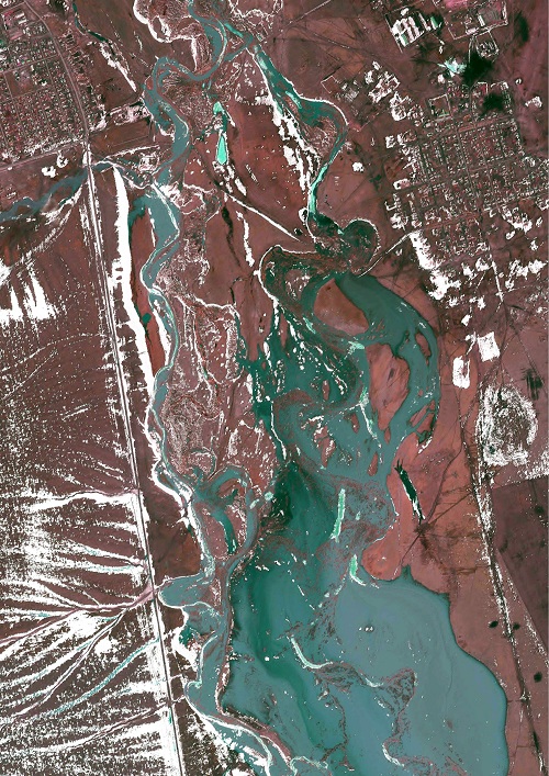
At the moment, there is a threat of flooding of 10 more villages in Akmola Oblast and Astana suburbs located near the riverbed of the Nura river.

Osakarovka suburb as photographed on 13 April from KazEOSat-1
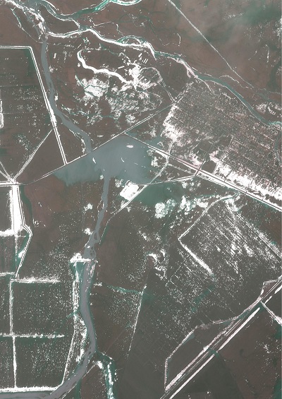
Koktenkol village as photographed on 13 April 2015 from KazEOSat-1

Vostok village. Photographed on 13 April from KazEOSat-1
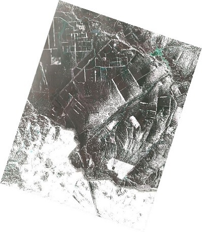
At 6 a.m. on April 14, the Bikesh river started overflowing its banks in Osakarov District of Karaganda Oblast. The flow of water crawled towards the outskirts of Kievka village. According to the press service of the Akimat (Governor's Office) of Karaganda Oblast, there is no danger to the village at this point.

"To ensure trouble-free passage of flood water and prevent flooding of houses, all the necessary organizational and practical measures are being taken,” the press service of the Oblast's Akimat said.

Kievka village, Nura District. April 13, 2015. KazEOSat-1 satellite. Panoramic view.
By Dinara Urazova

Читайте также
Join Telegram Последние новости
Stadium caught fire in Petropavlovsk
Tokayev met with experts in AI
Powerful earthquake struck Japan
Лого TengriNews мобильная Лого TengriLife мобильная Лого TengriSport мобильная Лого TengriAuto мобильная Иконка меню мобильная
Иконка закрытия мобильного меню
Открыть TengriNews Открыть TengriLife Открыть TengriSport Открыть TengriAuto Открыть TengriTravel Открыть TengriEdu Открыть TengriGuide

Exchange Rates

 530.22  course up  545.66  course up  5.17  course up


Weather


Редакция Advertising
Социальные сети
Иконка Instagram footer Иконка Telegram footer Иконка Vkontakte footer Иконка Facebook footer Иконка Twitter footer Иконка Youtube footer Иконка TikTok footer Иконка WhatsApp footer